
Conservation Commission
New London, New Hampshire 03257
Trails
Clark Lookout Trail
| Trail Number: | 2 | Trail Length: | .4 Mile (one way) |
| Difficulty: | Easy | Trailhead GPS: | |
| Trail Adopter: | Printer Friendly Description / Map / Elevations |
Trail Description
The lookout provides a spectacular view of Lake Sunapee and
Mount Sunapee as shown in photos to right. The lookout is a gift
from Sydney L. Crook to the town of New London for conservation
and recreation use. The road
leading to the lookout is on private property with an easement only for access to the
lookout. The road
easement also provides access for people with disabilities
(inquire at the town offices to borrow a key to the gate to
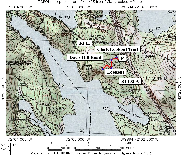
drive to the lookout). Walk on the roads indicated in red
on the map. The Clark Lookout Trail (in red on map) climbs from the
exit 12 Park
and Ride parking on Rt 103-A to the lookout on Davis Hill.
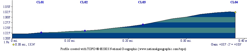
The trail profile is shown below. The trail is less than 0.4
miles (one way) and climbs 100 feet. The waypoints shown on the
map are identified on the profile. The first, CL01, is at the
intersection of Davis Hill Rd. and Rt 103-A, the second at the
wooden gate (first gate on left while walking up Davis Hill Rd.
shown in photo to right) which is the entrance to the road leading to the
lookout, the third is at the four corner road intersection (turn
right) and the last is at the lookout.
- See Map Below or
Return to Main Trails Page
Trail Map
Elevation Information
Photos

Clark Lookout - Photo by Peter Brodeur
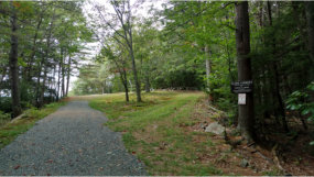
Approach to summit - Photo by Stanley Morono
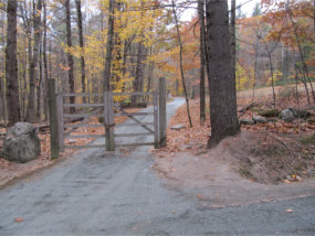
Clark Lookout gate - Photo by Stanley Morono