
Conservation Commission
New London, New Hampshire 03257
Trails
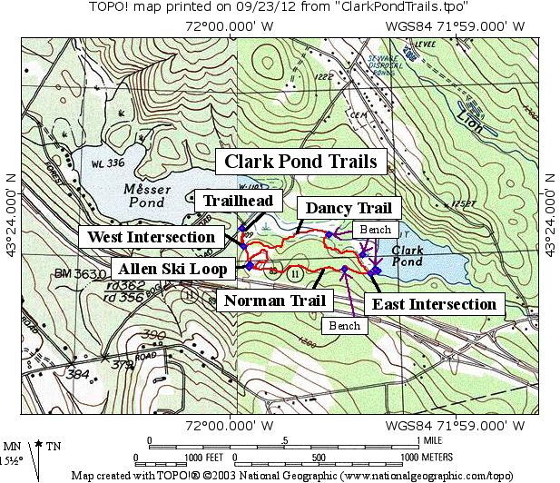
Clark Pond Trails
| Trail Number: | 3 | Trail Length: | 1.63 Miles |
| Difficulty: | Trailhead GPS: | ||
| Trail Adopter: |
Trail Description
The Clark Pond Loop Trail starts at the trailhead gate on
Bog Road, follows the path into the woods and then splits
left onto the Dancy Trail and right onto the Norman Trail. An interpretive brochure is available here
for downloading. A
new cross country ski loop has been added to the Norman
Trail. For winter use, the Dancy Trail is reserved for
snowshoeing and the Norman Trail and Ski Loop are for
skiing. The complete trail system is now 1.63 miles in
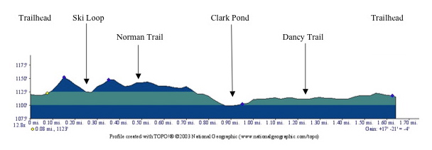
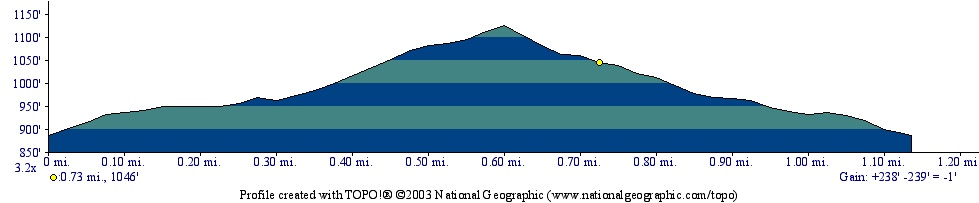
length including going around the ski loop as shown in the
trail profile. Parking is in front of the gate and along the
shoulder of Bog Road. Distances between identified points on
the map are listed below the profile.
- See Map Below or
Return to Main Trails Page.
Map
Elevation Information
|
Location on Map
|
Cumulative Distance
on Trails (miles) |
Distance Between
Locations (miles) |
Elevation
(feet.MSL) |
| Trailhead |
0
|
1118
|
|
| West Intersection |
0.08
|
0.08
|
1123
|
| Ski Loop |
0,15
|
0.07
|
1150
|
| Ski Loop |
0.38
|
0.23
|
1150
|
| East Intersection |
0.85
|
0.47
|
1102
|
| Clark Pond |
0.90
|
0.05
|
1099
|
| East Intersection |
0.95
|
0.05
|
1102
|
| West Intersection |
1.55
|
0.60
|
1123
|
| Trailhead |
1.63
|
0.08
|
1118
|
Photos
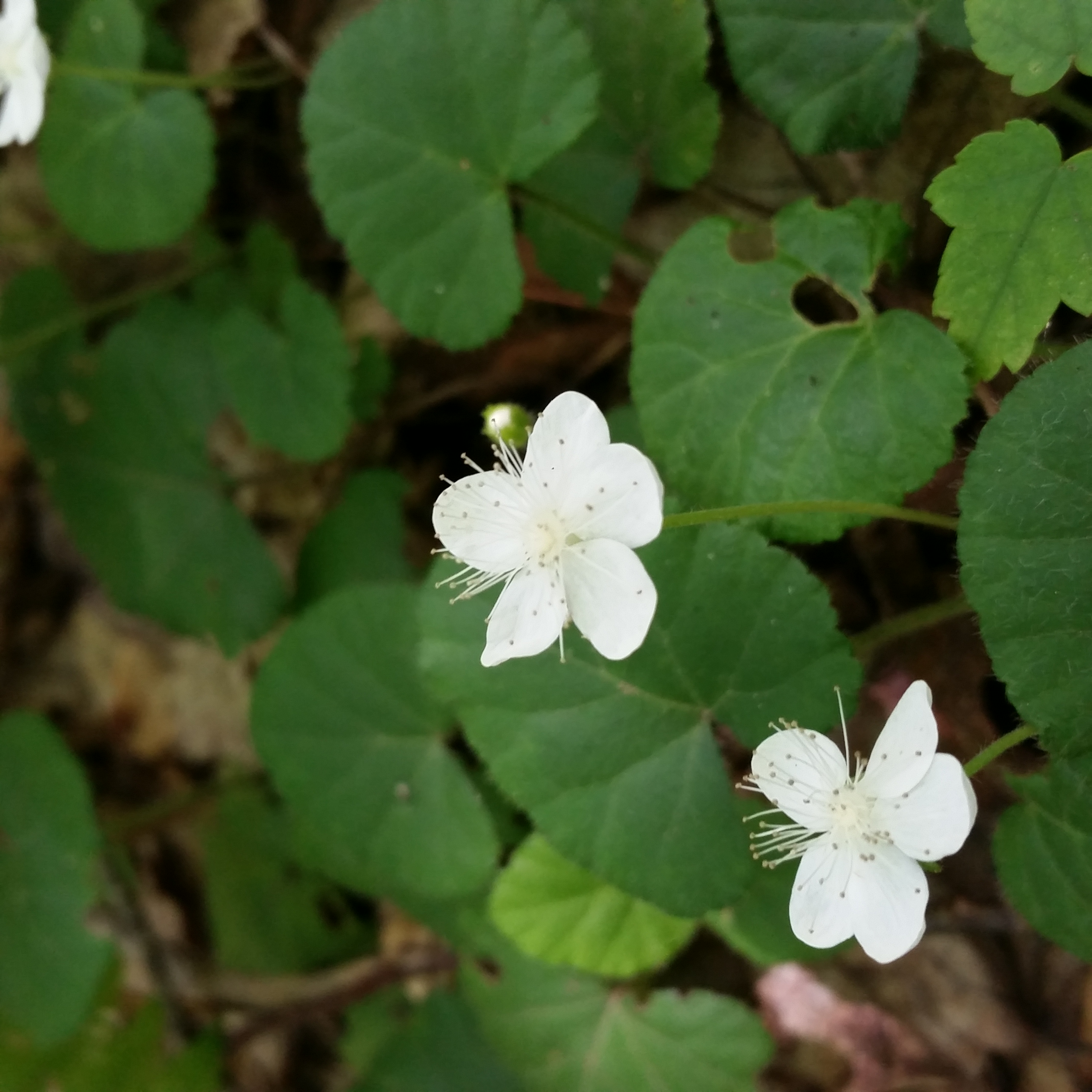
Dewdrop plant - Photo by Owen Krol
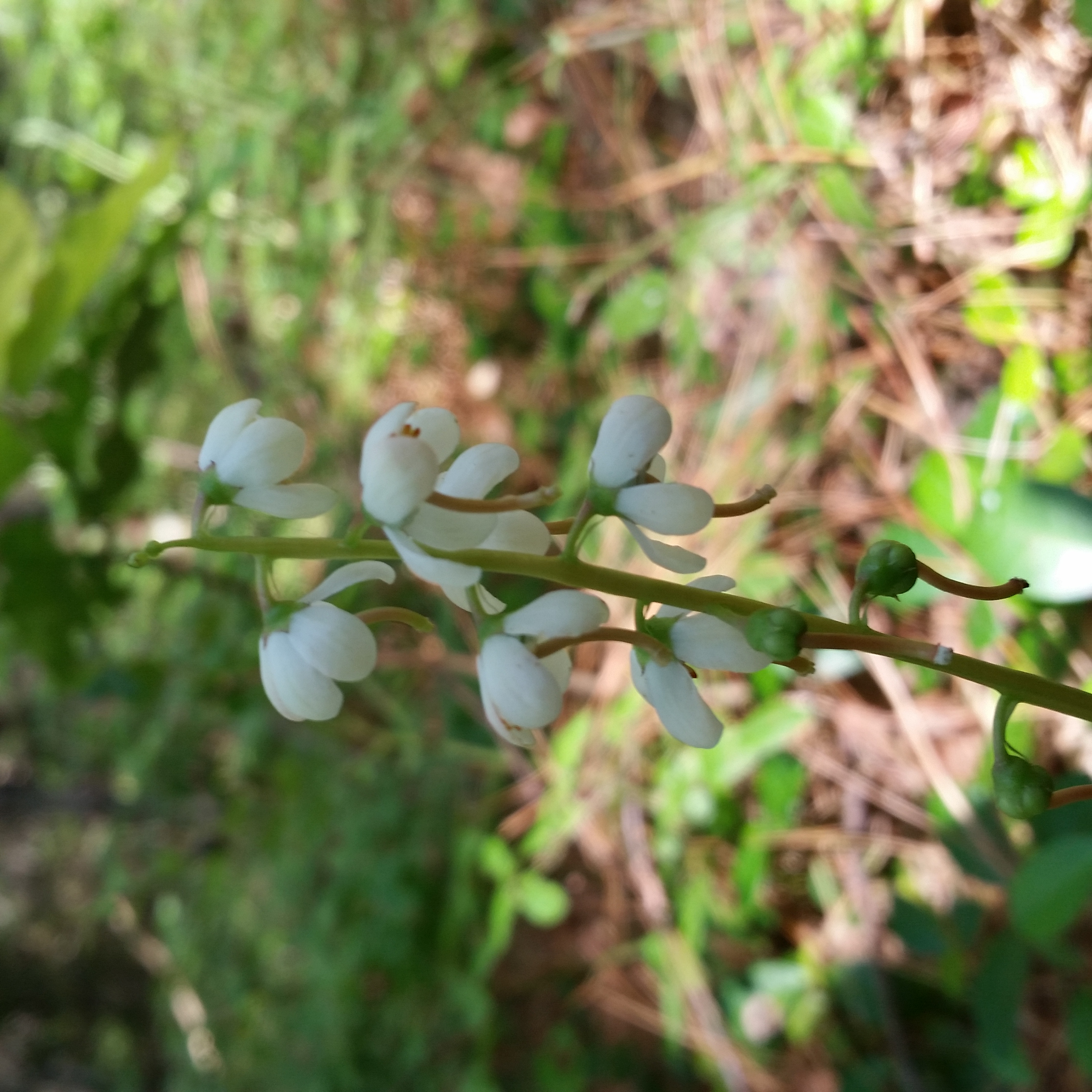
Shinleaf plant - Photo by Owen Krol

Trailhead Sign - Photo by Bob Brown

Clark Pond Trail - Photo by Peter Brodeur
Clark Pond Trails Bridge - Photo by Bob Brown

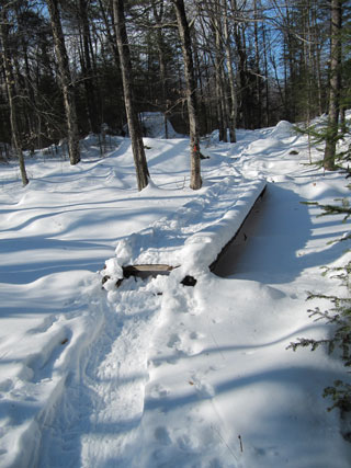
Clark Pond Winter Crossing - Photo by Bob Brown