
Conservation Commission
New London, New Hampshire 03257
Trails
Low Plains Trails
| Trail Number: | 15 | Trail Length: | 1 Mile (one way) |
| Difficulty: | Moderate | Trailhead GPS: | |
| Trail Adopter: |
Trail Description
A
self guided trail map
with notes is available here and at the Route 11
entrance. Winter travel by snowshoes or cross country skis
is popular. The trails in the Esther Currier Wildlife Management Area at
Low Plain may be accessed from the parking area (P) off Route 11
or from a parking area (P) on Mountain Road. The main trail is named the Davis Path. It is a gated
gravel road that runs between Route 11 and Mountain Road. Side
trails go to an overlook and to observation blinds along the
edge of an active Beaver Pond. A quaking bog may be viewed from a
boardwalk on the trail to the Marsh Point blind (not passable at
high water). A high water detour is also available for the Davis
Path. A geological exhibit (boulder collection) and a salamander
pool are visible from the Davis Path. The Davis Path is 1.1
miles in length (one way). A half mile loop trail to Shepard
Spring is also shown across Mountain Road from the Davis Path.
Parking is available along Mountain Road. The trail is only
marked for a clockwise trip around the loop. Note that the
Conservation Commission has also developed a a Forestry
Management
Cover Map and
Forestry Plan for the Low Plains area.
- See Map Below or
Return to Main Trails Page.
Trail Map

Elevation Information
Not available
Photos
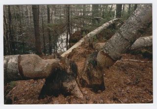
Beaver Activity - Photo by Margaret Enser
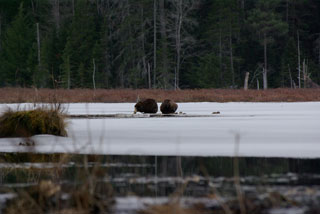
Beaver Pair - Photo by Peter Brodeur

Beaver Lodge - Photo by Bob Crane
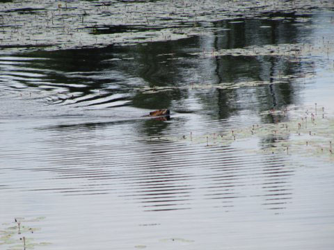
Beaver Swimming - Photo by Bob Brown