
Conservation Commission
New London, New Hampshire 03257
Trails
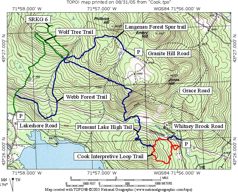
Cook Trails - Cook Interpretive Loop Trail
| Trail Number: | 5 | Trail Length: | 1.2 Mile Loop |
| Difficulty: | Trailhead GPS: | ||
| Trail Adopter: |
Trail Description
Interpretive fliers that describe the trees, shrubs and
geological features along the Cook Interpretive Loop Trail are
available in a box at the trail head. The numbers on the ASLPT
signs are keyed to the flier. The Cook Interpretive Loop Trail (pink flagged, indicated in
red on the map) starts at the
parking area (P) along Whitney Brook Road where the Ausbon
Sargent Land Preservation Trust (ASLPT) sign #49 is visible from
the road near the power line crossing. The trail's highest
elevation provides views of Ragged, Kearsarge, and Sunapee
Mountains. This trailhead also services the
Pleasant Lake High Trail. There are several other
possible Cook loop trails (flagged in blue, green, yellow, or
orange but not shown). The pink flagged trail indicated in
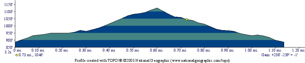
red on the map is 1.2 miles long
and climbs 240 feet to its high point. The
Pleasant Lake High Trail uses segments of the Cook
Interpretive Loop Trail and other Cook trails. Only the
Pleasant Lake High Trail is blazed, the rest are flagged
with colored ribbons. The yellow diamond at 0.72 miles from the
start of the Cook Interpretive Loop Trail on the profile below
is at the up hill intersection with the
Pleasant Lake High Trail.
- See Map Below or
Return to Main Trails Page.
Trail Map
Elevation Information
Photos

Entrance on Whitney Brook Road - Photo by Bob Crane

View of Kearsarge from Interpretive Trail
Photo by Bob Crane