
Conservation Commission
New London, New Hampshire 03257
Trails
Dura Crockett Trail
| Trail Number: | 7 | Trail Length: | .8 Mile (one way) |
| Difficulty: | Moderate | Trailhead GPS: | |
| Trail Adopter: |
Trail Description
Most of the Dura Crockett trail follows along the Dura
Crockett Brook providing views of picturesque falls and jumbled
rocks. The Dura Crockett Trail (in
red on map) climbs from the
Great Brook Trail (SRKG in green)
to the
Morgan Hill Trail (in blue). It
follows, then crosses, Dura Crockett Brook. It climbs 380 feet
in 0.8 miles from the intersection with the
Great Brook
Trail. This trail, when combined with the Great Brook and
Morgan Hill trails makes a round trip excursion of 3.7 miles
from the Pingree Road parking area (using the Pingree Connector
(blue) to access the Great Brook
Trail or 4.6 miles from the Lakeshore Road parking area (P).
Access is also possible from Morgan Hill Road via the
Morgan Hill Trail.
- See Map Below or
Return to Main Trails Page.
Trail Map

Elevation Information

Photos
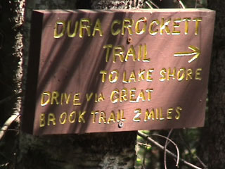
Sign from Morgan Hill Trail - Photo by Bob Crane
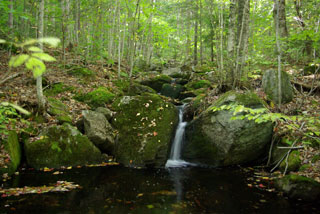
Dura Crockett Brook - Photo by Peter Brodeur

Bridge - Photo by Bob Brown
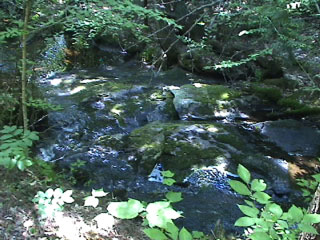
Dura Crockett Brook - Photo by Bob Crane