
Conservation Commission
New London, New Hampshire 03257
Trails
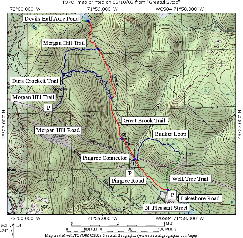
Great Brook Trail (SRKG)
| Trail Number: | 8 | Trail Length: | 1.6 Miles (one way) |
| Difficulty: | Moderate | Trailhead GPS: | |
| Trail Adopter: |
Trail Description
The Great Brook Trail follows the course of Great Brook and
offers views of water cascading down steep ledge in two
locations, which are particularly impressive with increased
water flows in the spring. A beaver dam is located
at the top of the trail at Devils Half Acre Pond. The Great Brook Trail (in red)
climbs from its start at Lakeshore Rd (point GB1) to Devils Half
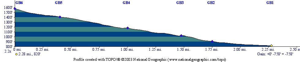
Acre Pond above the Upper Cascades (point GB6, in Wilmot). It
climbs 760 feet in 2.3 miles (one way). It is part of the
Sunapee Ragged Kearsarge Greenway
(SRKG) which continues on into Springfield (beyond GB6 in
green) or up the Wolf Tree Trail
(in green). Three access points
with parking (P) are shown on the map. The trail may be combined
with the
Dura Crockett and
Morgan Hill
Trails (in blue) or
the
Bunker Loop and Wolf Tree trails to provide loop hikes. The
section of trail between the bridge above the Lower Cascades
(point GB3) and the start at Lakeshore Rd is known (and signed)
as Cocoa's Path.
- See Map Below or
Return to Main Trails Page.
Trail Map
Elevation Information
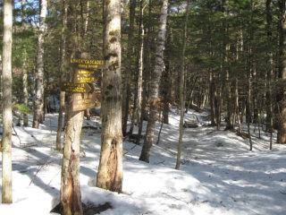
Photos

Lower Cascades - Photo by Peter Brodeur
Winter at Great Brook - Photo by Mark Vernon

Devil's Half Acre- Photo by Mark Vernon