
Conservation Commission
New London, New Hampshire 03257
Trails
Kidder Brook Trail
| Trail Number: | 10 | Trail Length: | 1.1 Miles (one way) |
| Difficulty: | Moderate | Trailhead GPS: | |
| Trail Adopter: |
Trail Description
There are many cascades and pools along the
trail and an old dam/mill site about 0.1 mile beyond the power
line. The Kidder Brook Trail (red on the map)
leaves the parking area at the Kidder Brook bridge on Twin Lake
Villa Road in Springfield. It crosses the stone bridge and ascends along Kidder Brook to the
SRKG Trail 5 (green on the
map). This trail
provides access to the
Greenway. When combined with
the lower section of the
Morgan Pond Trail, the Kidder Brook Trail provides a 2 mile
loop walk back to Kidder Brook bridge. The elevation profile
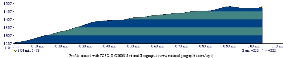
shows the trail ascends 230 feet in just over a mile.
- See Map Below or
Return to Main Trails Page.
Trail Map

Elevation Information
Photos

Compass Image Courtesy of Microsoft