
Conservation Commission
New London, New Hampshire 03257
Trails
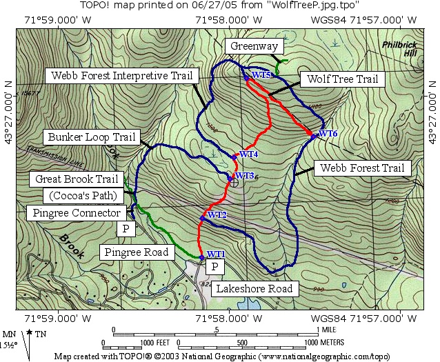
Wolf Tree Trail (SRKG)
| Trail Number: | 26 | Trail Length: | 1.6 Miles (one way) |
| Difficulty: | Moderate/Steep | Trailhead GPS: | |
| Trail Adopter: |
Trail Description
This trail is named for the unusually large crowned "wolf
trees" standing in the largely second-growth forest that
dominate their environment. An interpretive brochure is available here
for downloading. The Wolf Tree Trail (SRKG in
red on map) starts at the parking
area (P) on Lakeshore Road, intersects with the
Great Brook Trail (SRKG, also known
here as Cocoa's Path, in
green on map at waypoint
WT1), proceeds uphill to the
intersection with the
Webb Forest Trail (WT2), then
to the intersection with the
Bunker Loop Trail (WT3), to the
other end of the Webb Forest Trail (WT4),
to the connector trail (WT5) then
along the Wilmot, New London town line to terminate at the Webb
Forest Trail (WT6). Several loops
can be made using the Bunker Loop Trail and the Great Brook
Trail or in combination with sections of the Webb Forest Trail.
The trail extends 1.6 miles (one way), rises 670 feet from
Lakeshore Road to the intersection with the connector and then
descends 220 feet along the town line.
- See Map Below or
Return to Main Trails Page.
Trail Map
Elevation Information

Photos
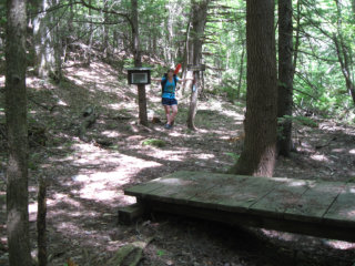
Junction of Wolf Tree, Webb Forest, and Langenau Forest trails. - Picture by Mark Vernon